CG Pro
Your map to smarter spending — visualize, analyze, and manage all your infrastructure from one platform.
 Click to expand
Visualize
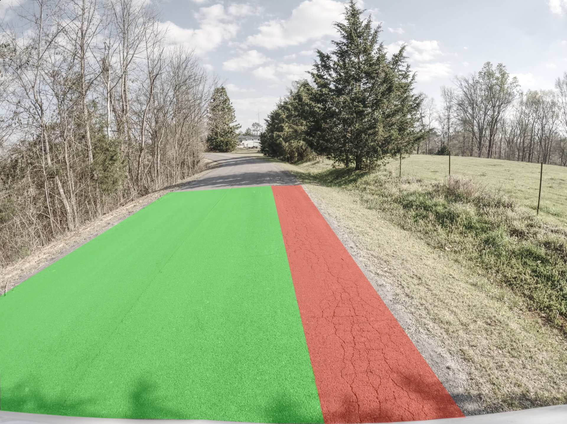
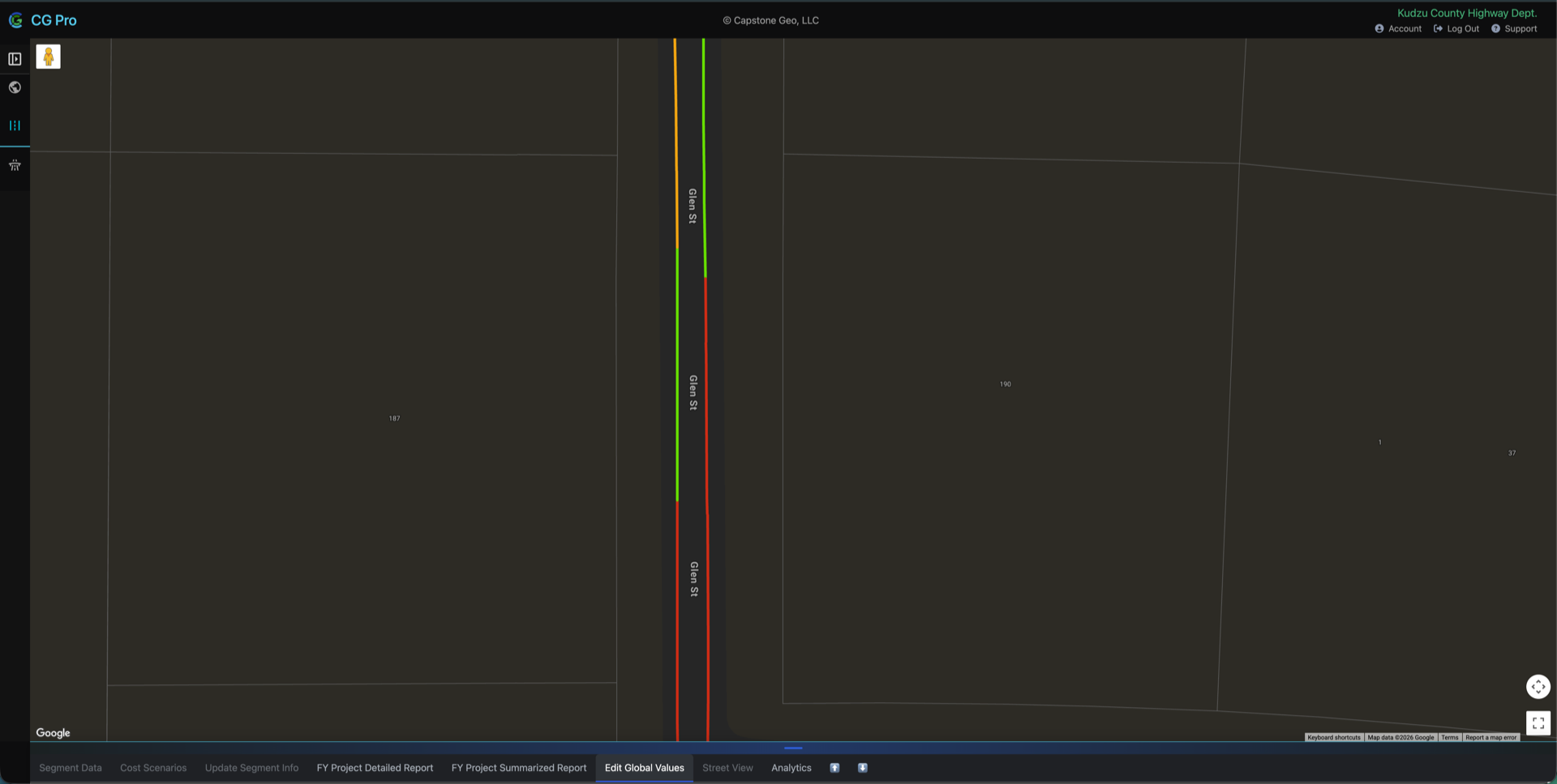
Interactive webmap labeled based on our Road Construction Index(RCI) and Lowest NBIS rating that allows you to get clear picture of your infrastructure network using custom overlays and boundaries.
- Road Construction Index Visualization
- Multi-layer Visualization
- Custom Symbology
 Click to expand
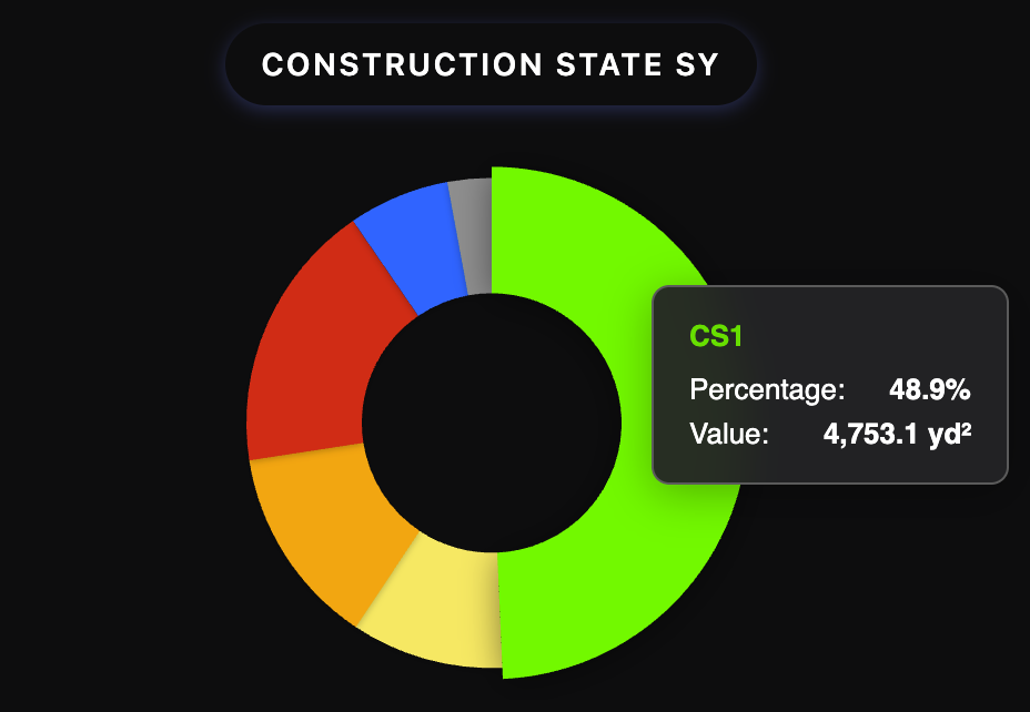
Analyze
Take collected data and turn it into actionable insights. Identify roads that need attention and prioritize your maintenance schedule based on construction state and usage data.
- Summary Of All Road Segments
- Priority Ranking
- Filtering based on Custom Criteria
 Click to expand
Manage
Plan projects with the data you've collected and analyzed. Keep track of past, present, and future projects.
- Cost Scenarios
- Automatic Cost Reports
- Custom Project Creation